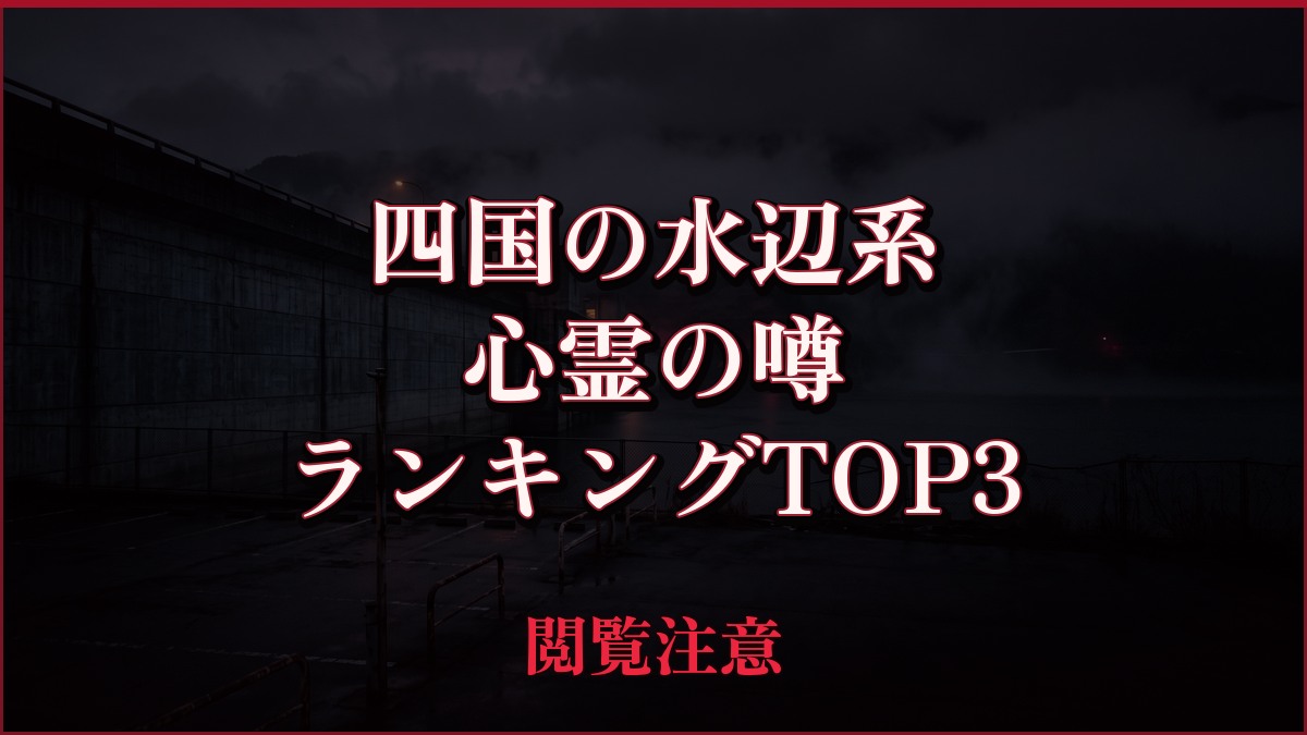
The paranormal rumors surrounding dams, capes, and coastal roads in Shikoku are a mix of historical information about the facilities, actual accidents, and unverified accounts of strange occurrences. This article examines three locations—Ishitegawa Dam, the area around Sadamisaki Lighthouse, and the Naruto Skyline—and compares claims against publicly available information from national and local governments and facility guides. The ranking reflects the quality of the materials used for verification, not the perceived frightness or truthfulness of the supernatural events.
Survey methods and evaluation criteria
From the rumor posting pages, we separated specific dates, uses, accidents, and eyewitness accounts into atomic claims and compared them with independent official and administrator documents. The judgment was as follows: "Consistency" if all claims are supported; "Partial Consistency" if there is a mix of supported and unconfirmed claims; and "Disagreement" if even one claim directly contradicts another. If a direct comparison is not possible, it is "Unmeasurable," and only if a comparison judgment is not possible but important information not found in the rumor is confirmed in official documents is it considered "New Fact." The mere existence of a location or matching address is not considered to support the supernatural phenomenon. The ranking was evaluated on a total of 100 points, with 30 points for source transparency, 25 points for historical and spatial context, 20 points for safety information, 15 points for the recency of the information, and 10 points for the source transparency of the rumor.
| Rank | point | The main points of the rumor | judgement | Document quality |
|---|---|---|---|---|
| 1 | Ishitegawa Dam | The page containing the rumors describes the Ishitegawa Dam as "a multi-purpose dam in Shukuno-cho, Matsuyama City, completed in 1972." It then goes on to say that "several suicides have occurred there in the past," and that bodies have been found there during droughts... | mismatch | 94/100 |
| 2 | Sadamisaki Lighthouse and Toyo Fortress Battery Ruins | The page containing the rumor describes the facilities related to the Sadamisaki Lighthouse and the Toyo Fortress Battery Ruins as "the remains of the Toyo Fortress battery located at the tip of the Sadamisaki Peninsula," and states that they were developed from 1924 for the defense of the Toyo Strait... | Partial match | 88/100 |
| 3 | Naruto Skyline (near Shihomi Observatory) | The rumored page mentions a story related to the Naruto Skyline (near the Shihomi Observatory), stating that "around 2:30 PM on March 13, 2015," two motorcycles collided head-on on a prefectural road in Naruto City... | unmeasurable | 84/100 |
1st Place: Ishitegawa Dam | Mismatch (94 points)
The rumored details
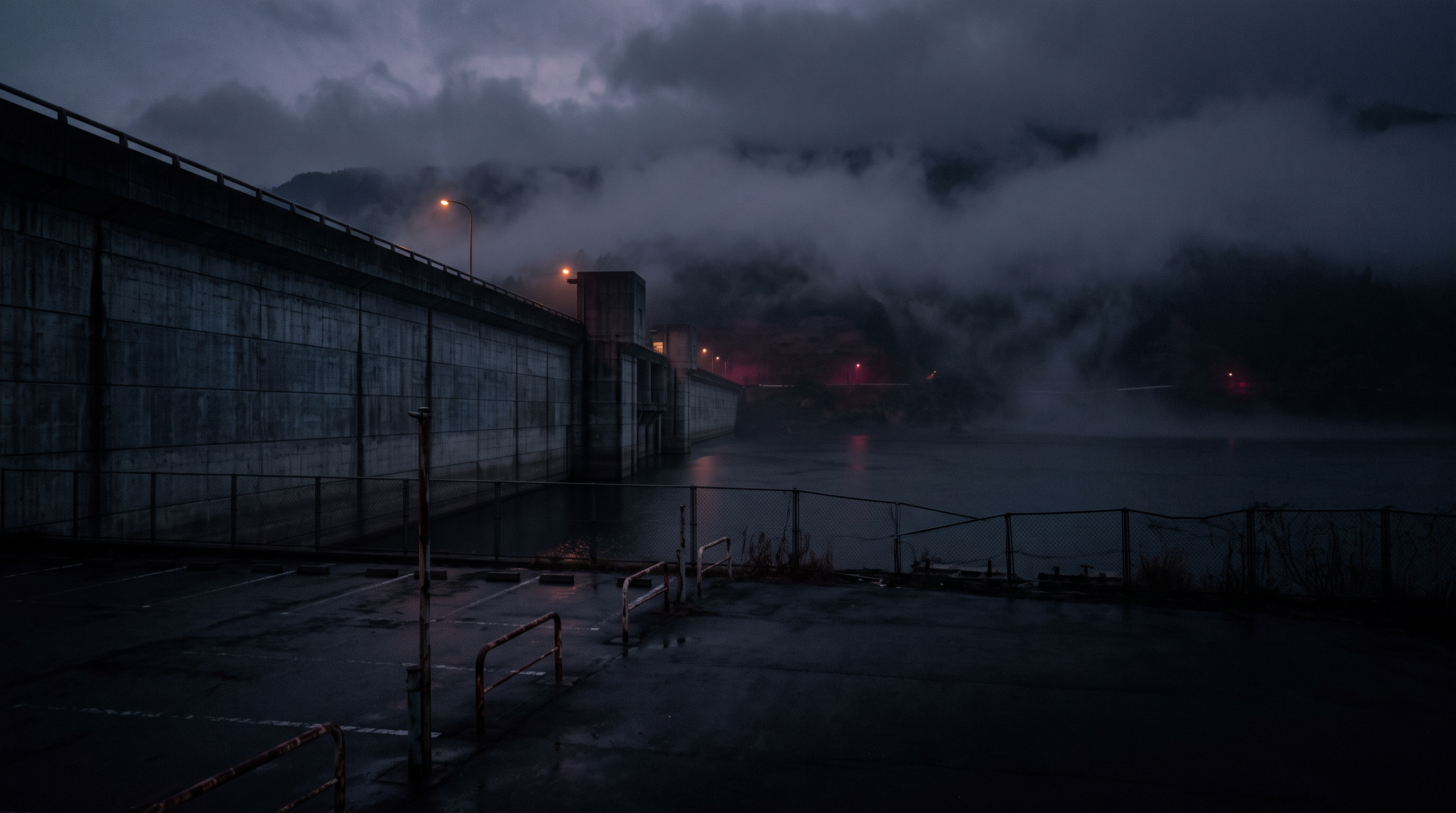
The rumor page describes the Ishitegawa Dam as "a multi-purpose dam in Shukuno-cho, Matsuyama City, completed in 1972." It then states that "several suicides have occurred there in the past," that bodies are sometimes found during droughts, and that a male ghost has been sighted near the dam. It also includes a story about a girl being murdered in a toilet in the parking lot, and a sighting of a black shadow disappearing from near a vending machine towards a pillar. All of these are claims made on the rumor page and have not been confirmed as facts regarding any incidents or strange occurrences.
Source of the rumor and date of verification
I checked the individual page for the Ishitegawa Dam on the National Haunted Map as an example of secondary publication. The page contains information about the completion year, multiple incidents, the spirits of a man and a girl, and a black shadow, but for claims other than the completion year, there are no direct links to official records or original news articles, and the original source is unknown.
- Nationwide Haunted Map: "Ishitegawa Dam"(Date confirmed: 2026-09-20) — A secondary publication page containing information about the building's completion in 1972, unconfirmed stories about suicides and incidents in the parking lot, and eyewitness accounts of male and female ghosts and black shadows.
Things that could be confirmed from official and primary source materials
Regarding the Ishitegawa Dam, the Ministry of Land, Infrastructure, Transport and Tourism's Shikoku Regional Development Bureau's management branch page lists the reservoir name as Shirasagi Lake, the river system as the Shigenobu River system (a first-class river), the river name as Ishitegawa, and the administrator as the Ministry of Land, Infrastructure, Transport and Tourism. The completion date is listed as "March 1973" (Showa 48). The location is listed as Yuyama-yanagi, Matsuyama City on the right bank and Shukuno-cho, Matsuyama City on the left bank, and it is also specified that the dam is 87 meters high and has a crest length of 278 meters. The official page that was checked does not contain any information about suicides, the murder of a young girl, or ghosts or dark shadows.
- Ministry of Land, Infrastructure, Transport and Tourism, Ishitegawa Dam Management Branch Office, "Dam Overview"(Confirmed on 2026-09-20) — The reservoir is named Shirasagi Lake, the river is named Ishite River, the completion date is March 1973, the administrator is the Ministry of Land, Infrastructure, Transport and Tourism, the height is 87m, and the crest length is 278m.
Points of agreement/contradictions
Regarding the rumored claim that the building was completed in 1972, the administrator's documents state the completion date as March 1973, or Showa 48. A direct comparison of the completion dates of the same facility reveals that the years do not match. On the other hand, the stories of multiple suicides, the incident in the parking lot, and the ghosts and black shadows are outside the scope of the Ministry of Land, Infrastructure, Transport and Tourism pages obtained this time, and the mere fact that they are not mentioned will not be used as counter-evidence.
| The rumored atomic claim | Matching results | reason | Corresponding documents |
|---|---|---|---|
| A multi-purpose dam in Shukuno-cho, Matsuyama City, completed in 1972. | contradiction | The Ministry of Land, Infrastructure, Transport and Tourism's administrative documents clearly state the completion date as March 1973 (Showa 48), which does not match the rumored date of 1972. | Ministry of Land, Infrastructure, Transport and Tourism, Ishitegawa Dam Management Branch Office, "Dam Overview" |
| There have been many suicides in the past. | Unconfirmed | The administrator documents obtained were pages dealing with the facility's overview, and no references to public records that could verify the number of people or events were found. | No official data available for direct comparison. |
| A girl was murdered in a parking lot restroom. | Unconfirmed | Aside from the rumor page, there were no dates or official records that could identify the incident, and we were unable to directly compare it with the Ministry of Land, Infrastructure, Transport and Tourism documents we checked. | No official data available for direct comparison. |
| A dark shadow disappears from near the vending machine towards the pillar. | Unconfirmed | This is a subjective eyewitness account, and since we cannot obtain independent data from others who have observed and verified the same phenomenon, we cannot support or refute it. | No official data available for direct comparison. |
Alternative interpretation
The discrepancy in the completion year may be due to confusion of different milestones, such as the completion of the main construction phase, trial operation, completion ceremony, and commencement of management. However, since the rumor page does not provide evidence for 1972, we will prioritize the March 1973 date specified by the administrator at this time. There is also no evidence to definitively conclude that shadows cast by the water surface or lighting are the cause of the strange occurrences.
Scope and limitations of the investigation
The official documents we consulted this time were an overview of the dam and surrounding area information, and did not comprehensively cover police records, past newspaper articles, or accident statistics. Therefore, we have not been able to confirm the veracity of the incident stories and death tolls presented. We limited the confirmed inconsistencies to the completion date, and other claims were left unresolved due to insufficient evidence.
Verification result: Mismatch
Regarding the completion date of the Ishitegawa Dam, the rumor page states 1972, while the Ministry of Land, Infrastructure, Transport and Tourism's administrative documents clearly state March 1973 (Showa 48), so the dates are directly contradictory. In the judgment rules, if there is even one directly contradictory claim, "inconsistency" takes precedence. However, this judgment is based on the completion date and does not prove that no strange occurrences or unconfirmed incidents occurred.
Document Quality Score
| Source transparency | 30/30 | You can directly check the individual pages for the rumored projects and the facility overview pages of the Ministry of Land, Infrastructure, Transport and Tourism's management branch offices via separate URLs, and compare the completion dates on a case-by-case basis. |
|---|---|---|
| Historical and spatial context | 24/25 | You can find detailed information in official documents, including the completion date, the location of the left and right banks, the river system, the river name, the administrator, and the dimensions of the dam body. |
| Safety information | 17/20 | While the locations of the management branch and surrounding facilities can be confirmed, the acquisition page does not include information on nighttime use or detailed access conditions for individual areas. |
| Newness of information | 14/15 | The administrator site contains update information for 2026, and the rumor page also shows an update history from September 2025. |
| Transparency of the source of rumors | 9/10 | While the rumor text and page update history can be tracked, the original publication records and news reports of the incidents and eyewitness accounts are not provided. |
| total | 94/100 | This is the overall quality of the materials. It does not represent the degree of truthfulness or danger associated with the supernatural phenomena. |
Safety information and maps
There are dangerous areas around the dam body, reservoir, waterfront, and management facilities. Please follow the signs and instructions from the management, and avoid nighttime visits, roadside parking, and approaching the water surface. Do not descend to the lakebed or slopes, even during low water levels.
Map location: The coordinates shown are those of the Ishitegawa Dam embankment, as confirmed on publicly available maps.
2nd Place: Sadamisaki Lighthouse and Toyo Fortress Battery Ruins | Partial Match (88 points)
The rumored details
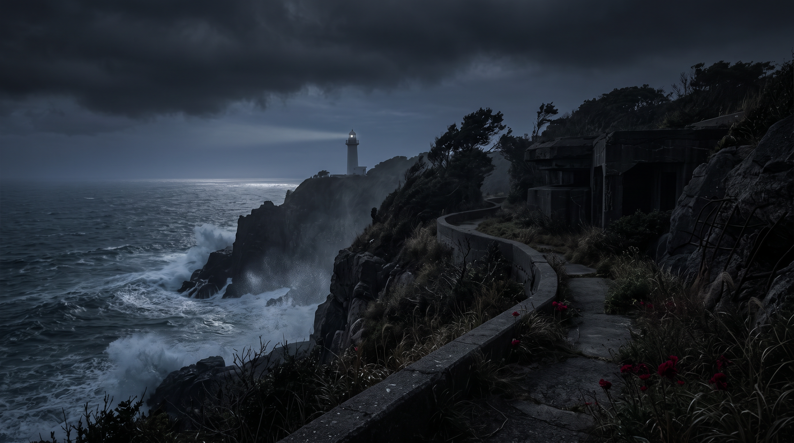
The rumor-posting page describes the facilities related to the Sadamisaki Lighthouse and the Toyo Fortress Battery Ruins as "the remains of the Toyo Fortress battery located at the tip of the Sadamisaki Peninsula," stating that they were constructed from 1924 to defend the Toyo Strait and were abolished at the end of the war in 1945. Furthermore, it states that "part of it was renovated for tourism in 2017," and then posts a story that a ghost appears because "a suicide by hanging occurred on the footpath leading up to the first battery facility." The incident and the strange occurrences are claims made by the rumor-posting page and are not treated as officially confirmed facts.
Source of the rumor and date of verification
I checked the "Toyo Fortress Cave-Type Gun Battery Ruins" page on the National Haunted Map as an example of secondary publication. It lists the dates of the gun battery's maintenance, decommissioning, and development as a tourist attraction, as well as anecdotes about incidents on the footpath, but it does not indicate the date of the incidents, news reports, police records, or the first recorded occurrences of the paranormal activity. The page itself also includes a disclaimer acknowledging the lack of primary information.
- Nationwide Haunted Map: "Toyo Fortress Cave-Type Gun Battery Ruins"(Verification Date: 2026-09-20) — This article contains rumors about the Toyo Fortress Battery at the tip of the Sadamisaki Peninsula, which was developed from 1924, decommissioned in 1945, and developed for tourism in 2017, and that it is linked to an incident on the footpath.
Things that could be confirmed from official and primary source materials
Regarding the Sadamisaki Lighthouse and the Toyo Fortress Battery Ruins, the Sadamisaki Tourism Association's guide explains that the Sadamisaki Lighthouse stands at the tip of the peninsula within the Setonaikai National Park and was lit in April 1918. The lighthouse is approximately 1.8 kilometers from the parking lot, a paved walking path that takes about 20 minutes to reach, and includes long slopes and stairs. The guide also explicitly states that "the rock face where the lighthouse stands contains the remains of the former Imperial Japanese Army's Toyo Fortress battery," confirming the spatial relationship between the lighthouse and the battery ruins. There is no mention of suicides or ghosts on the walking path.
- Sadamisaki Tourism Association "Sadamisaki Lighthouse"(Confirmed on 2026-09-20) — The Sadamisaki Lighthouse was lit in April 1918, and a paved walking path of approximately 1.8 km extends from the parking lot. The guide also points out that the remains of the former Imperial Japanese Army's Toyo Fortress gun battery are located on the rock face where the lighthouse stands.
Points of agreement/contradictions
The rumored site of the Toyo Fortress gun battery at the tip of the Sadamisaki Peninsula matches the location and position of the site, as the tourism corporation guides visitors to the rock face where the lighthouse is located, stating that the remains of a former Imperial Japanese Army gun battery are still there. However, the dates of development from 1924, decommissioning in 1945, and tourism development in 2017 cannot be directly confirmed from the official website alone. There is also no independent evidence to support the claims of an incident on the footpath and the ghosts.
| The rumored atomic claim | Matching results | reason | Corresponding documents |
|---|---|---|---|
| The remains of a gun battery at Toyo Fortress, located at the tip of the Sadamisaki Peninsula. | support | The tourism corporation has clearly stated that the remains of the former Imperial Japanese Army's Toyo Fortress gun battery are located on the cliff face where the Sadamisaki Lighthouse stands, and the location matches the subject. | Sadamisaki Tourism Association "Sadamisaki Lighthouse" |
| Part of it was renovated for tourism in 2017. | Unconfirmed | While the current walking trails and their use for tourism can be confirmed from the official guide, we were unable to find any direct information confirming that they were renovated in 2017. | No official data available for direct comparison. |
| A suicide by hanging occurred on the walkway leading up to the first gun battery facility. | Unconfirmed | The rumor page lacks dates and references to official records, and the tourism agency's guide does not contain any descriptions that allow for direct comparison with the same incident. | No official data available for direct comparison. |
Alternative interpretation
The proximity of multiple elements such as a lighthouse, walking paths, former military facilities, and steep slopes and stairs may have intertwined the history of the gun battery site with later accounts of incidents, forming a single narrative. However, there are no original documents illustrating this formation process, and it is impossible to infer any incidents or strange occurrences solely from the landscape or the presence of former military facilities.
Scope and limitations of the investigation
The scope of our verification was limited to the individual pages on the National Haunted Map and the lighthouse guide from the Sadamisaki Tourism Association. The tourism association's page describes the history of the facility, its highlights, and routes, but it is not a comprehensive record of incidents. We were unable to obtain the original historical documents or incident records from the walking paths for each of the years mentioned in the rumors, and those parts remain unverified.
Verification results: Partial match
The specific location and relationship of the former Imperial Japanese Army's Toyo Fortress gun battery ruins, located near the lighthouse at the tip of the Sadamisaki Peninsula, were confirmed by the tourist association's guide. On the other hand, the dates 1924, 1945, and 2017 mentioned in the rumors, as well as the suicides on the sidewalk and the appearance of ghosts, cannot be confirmed in this independent document. Because supported elements and unconfirmed claims coexist, it is described as "partial agreement."
Document Quality Score
| Source transparency | 28/30 | You can directly access individual pages about the rumored sites and the tourism corporation's lighthouse guide, and track the targets and locations of the gun battery ruins. |
|---|---|---|
| Historical and spatial context | 23/25 | You can find out about the lighthouse's operating schedule, its role in navigation safety, and its location relative to the former Imperial Japanese Army gun battery site through the manager's guidance. |
| Safety information | 18/20 | The distance from the parking lot, walking time, paved walking paths, long slopes and stairs, and recommended attire are all provided in detail. |
| Newness of information | 11/15 | I was able to retrieve both pages at this time, but the official page does not clearly display the last update date of the text information. |
| Transparency of the source of rumors | 8/10 | While the specific dates and details of the incidents mentioned in the rumors are available, the original sources for the incidents and strange occurrences on the sidewalks are not provided. |
| total | 88/100 | This is the overall quality of the materials. It does not represent the degree of truthfulness or danger associated with the supernatural phenomena. |
Safety information and maps
The lighthouse is approximately 1.8 kilometers from the parking lot and involves a long uphill climb and stairs. Please wear comfortable clothing and visit during the daytime. Do not stray from the publicly accessible route and do not enter closed areas of the former military facility, cliffs, or the waterfront.
Map Location: The coordinates shown are those of the tip of the peninsula, identified as the Sadamisaki Lighthouse on publicly available maps.
Check the area around Sadamisaki Lighthouse and Toyo Fortress Battery Ruins on Google Maps.
3rd Place: Naruto Skyline (near Shihomi Observatory) | Unmeasurable (84 points)
The rumored details
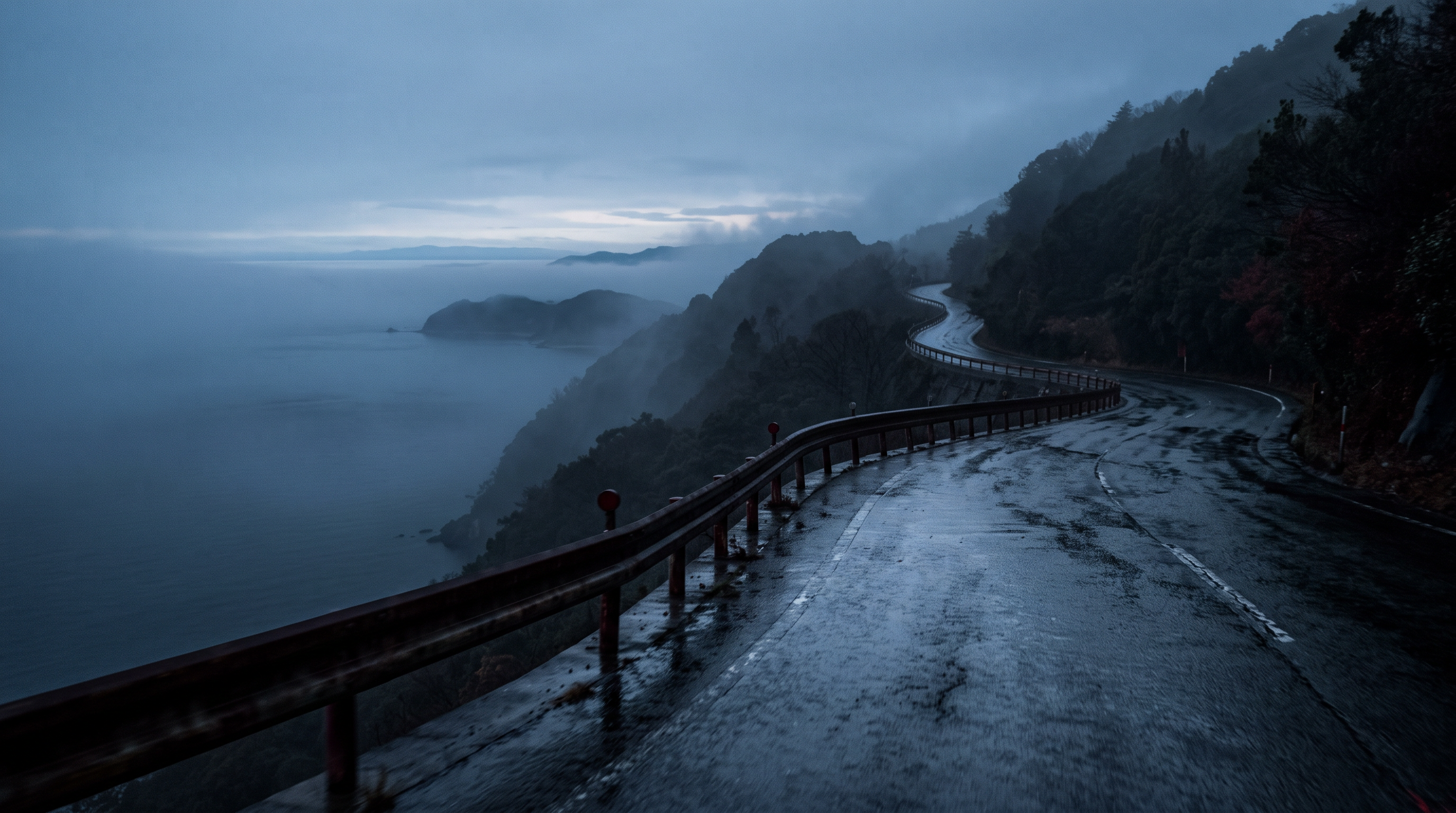
The page listing the rumor states that, related to the Naruto Skyline (near the Shiozaki Observatory), two motorcycles collided head-on on a prefectural road in Naruto City "around 2:30 p.m. on March 13, 2015," resulting in "the deaths of two drivers." Furthermore, it mentions that one of the deceased was a person known for dressing up as Kamen Rider, linking this to the rumor that he "appears on the Naruto Skyline at night." There is also a separate category of animal spirits appearing, but the page explicitly states that there is a lack of primary source information.
Source of the rumor and date of verification
I checked the Naruto Skyline page on the National Haunted Map as an example of secondary publication. The accident section is listed as being from the local edition of the Mainichi Shimbun on March 14, 2015, but there is no public link to the newspaper article itself, and I have not directly obtained the original text. The identity of the person, the appearance stories, and the first appearance of the animal spirits are also unknown.
- Nationwide Haunted Map: "Naruto Skyline"(Verification Date: 2026-09-20) — A secondary posting page describing a head-on collision involving two motorcycles on March 13, 2015, resulting in the deaths of both drivers, and linking it to a rumor that one of the deceased appeared on the Naruto Skyline at night.
Things that could be confirmed from official and primary source materials
Regarding the Naruto Skyline (near the Shiozaki Observatory), the official Naruto City tourism website has published a 5-hour model course by car that visits Naruto Park, the whirlpool viewing boat, the Shiozaki Observatory, and the Kurukuru Naruto roadside station. The Shiozaki Observatory is placed third on the course as a point to view the "heart-shaped island 'Kagashima'," and it is indicated that it is about a 5-minute drive from the whirlpool viewing boat and about 25 minutes to the next roadside station. The official page obtained does not contain any information about the 2015 motorcycle accident, the identity of the deceased, nighttime sightings, or animal spirits.
- Naruto City Official Tourism Website: "A 5-Hour Model Course for Driving Through the Nature of the Naruto Strait"(Confirmed on 2026-09-20) — This is presented as a 5-hour model course that takes you by car to Naruto Park, a whirlpool viewing boat, the Shihomi Observatory, and the Kurukuru Naruto roadside station.
Points of agreement/contradictions
The official tourism page confirmed that the Shihomi Observatory is located on a driving route around the Naruto Strait. However, we could not obtain any official documents that directly support or deny the core rumors: the fatal accident on March 13, 2015, the deceased's profile, nighttime appearances, or animal spirits. Confirming the location of a tourist spot does not prove the supernatural occurrences, and the lack of mention on the official page does not refute them.
| The rumored atomic claim | Matching results | reason | Corresponding documents |
|---|---|---|---|
| Around 2:30 PM on March 13, 2015 | Unconfirmed | The rumor page mentions newspaper names, but the original articles cannot be directly accessed, and the official tourism page does not cover accident records, so independent verification is not possible. | No official data available for direct comparison. |
| Two drivers died. | Unconfirmed | Without police announcements or directly obtained news reports confirming the death toll, this independent document cannot either support or refute the claims. | No official data available for direct comparison. |
| Appears on the Naruto Skyline at night | Unconfirmed | These are subjective accounts of sightings, and since there is no data from independent observations of the same object and phenomenon, a factual comparison is not possible. | No official data available for direct comparison. |
Alternative interpretation
The environment—a curved road along the coast, a viewpoint, and the darkness at night—may have led to the spread of memories of the accident and stories about the people involved. However, there is no observational data to suggest that lighting, reflections, or animals were the cause of the eyewitness accounts, and therefore, it is not possible to definitively conclude that the explanation was due to natural phenomena.
Scope and limitations of the investigation
I checked individual pages on the National Haunted Map and the model courses on the Naruto City official tourism website. I was unable to directly obtain the original newspaper articles, police statements, and accident statistics cited on the rumor page. Therefore, I will not confirm the details of the accidents or the identity of the individuals as fact, and I reserve judgment on supporting or refuting the claims of paranormal activity.
Verification result: Unmeasurable
While the tourist location of the Shihomi Observatory could be confirmed, this does not corroborate the 2015 accident or the nighttime sightings. We were unable to obtain any independent primary sources that could confirm the date and time of the accident or the number of fatalities, any materials that could identify the deceased, or any observational records that could be used to compare the strange occurrences. Since neither support, partial support, nor direct contradiction holds true, we limited the scope of comparison to the specific claims of the rumors and classified it as "unmeasurable."
Document Quality Score
| Source transparency | 27/30 | While you can directly access the individual pages about the rumors and the official tourism articles from Naruto City, you cannot track down the original newspaper articles that the rumors quote. |
|---|---|---|
| Historical and spatial context | 19/25 | While the location and travel time to the Shihomi Observatory on the tourist route can be confirmed, no official records of the accident have been obtained. |
| Safety information | 17/20 | The official article shows the order and estimated time for visiting the locations by car, but it does not include detailed information on road restrictions or usage conditions for viewpoints. |
| Newness of information | 13/15 | The official tourism article is dated January 28, 2026, and we were able to directly check the publication and update status of the rumors page. |
| Transparency of the source of rumors | 8/10 | The date and time of the accident and the name of the newspaper are listed, but the link to the original article, the first appearance of the strange phenomenon, and the basis for the identification of the individuals are not provided. |
| total | 84/100 | This is the overall quality of the materials. It does not represent the degree of truthfulness or danger associated with the supernatural phenomena. |
Safety information and maps
Because the route includes winding coastal roads and scenic viewpoints, please avoid checking your surroundings while driving or stopping on the roadway. Do not make nighttime visits your primary objective; use designated parking areas and follow traffic regulations and the latest information from local authorities.
Map location: The coordinates shown are those confirmed on public maps as the Naruto Skyline Observation Parking Lot.
Check the area around Naruto Skyline (near Shihomi Observatory) on Google Maps.
What I learned by crossing locations
While pages listing the rumors exist for all three locations, the scope confirmed by official documents differs significantly. At Ishitegawa Dam, there are records that allow for direct comparison of the completion date, and the rumored 1972 differs from the official March 1973. At Sadamisaki, the existence and location of the gun battery remains match, but no incidents or strange occurrences on the footpath have been confirmed. At Naruto, while the tourist location of the Shihomi Observatory can be confirmed, primary sources to corroborate accident reports or sighting stories could not be obtained. The absence of mention of strange occurrences in official documents does not necessarily negate the rumors.
summary
The clearest difference we could confirm was the completion date of the Ishitegawa Dam. Around the Sadamisaki Lighthouse, we were able to confirm the spatial framework of the former Imperial Japanese Army's Toyo Fortress gun battery remains, but the rumored incident could not be corroborated. The Naruto Skyline also could not be independently confirmed as to whether the accident and the sighting stories were true, making it impossible to measure. It is important to distinguish between the existence of names and facilities along the waterfront and whether the strange occurrences described there are factual.
FAQ
Does this ranking reflect the level of fear associated with paranormal phenomena?
No. The rankings and scores are based on an evaluation of the quality of the verifiable information, including whether the source of the rumor and official documents can be traced, whether the historical and geographical context is specific, and whether safety information is included.
If there is no mention of the supernatural phenomenon in the official documents, does that mean there is a discrepancy?
The mere lack of information will not be considered a discrepancy. A contradiction will only be identified if official documents clearly show different facts regarding the same period, incident, or use, and if there is no comparative data, it will be considered unconfirmed or unmeasurable.
Is it okay to go to the listed location at night?
Nighttime visits and daredevil activities are not recommended. Avoid stopping on the road, entering restricted areas, and approaching waterfronts or steep slopes. Prioritize the latest information regarding opening hours, traffic restrictions, and the administrator's guidelines.
How to read this article and safety precautions
" [2026 Latest] Top 3 Ranking of Paranormal Rumors Related to Waterfronts (Waterfalls, Lakes, Dams, and the Sea) in Shikoku This is an article compiled by the Horror Tales File editorial team as a story, based on publicly available information, rumors circulating in the community, and information submitted by readers. It does not definitively state the authenticity of paranormal phenomena.
- We do not recommend visiting restricted areas, private property, abandoned buildings, or dangerous locations at night.
- If you go to the site, always prioritize compliance with laws and regulations, instructions from facility managers, and consideration for nearby residents.
- You can submit personal experiences, correction requests, and deletion requests through the "Personal Experiences/Information Submission" or "Contact Us" sections.
View editorial policy / Please share your experiences and information here. / inquiry